
On the southern edge of the Khasi Hills, where the monsoon winds hit the first high ground north of the Bay of Bengal, two towns fight over a soggy title. Mawsynram averages about 11,900 mm of rain a year, which is nearly 12 metres. Cherrapunji, now officially called Sohra, still holds the world records for the most rain in a single month and a single year.
Between them lie canyons, plunge waterfalls, limestone caves and the living root bridges of the Khasi people, grown over decades from the roots of rubber fig trees. This guide covers how to visit both towns, the root-bridge trek, and why going in the monsoon is both the point and the problem.
The route at a glance
Tap a dot for details. Drag and zoom to explore.
Which is wetter?
On average, Mawsynram: about 11,872 mm a year against Sohra’s roughly 11,800 mm, and the gap has been widening as Sohra’s rainfall has trended down. Colombian towns such as Lloró and López de Micay claim even higher averages, so “wettest place on Earth” is contested.
But Sohra (Cherrapunji) holds the records nobody has beaten: 9,300 mm in July 1861, the most rain ever measured in one calendar month, and about 26,470 mm between August 1860 and July 1861, the most in a year.
The strangest part: in winter, Sohra runs short of water. From November to February it barely rains, and the thin soils hold little, so people walk long distances for drinking water in one of the wettest places on the planet.
Getting there
Fly to Guwahati in Assam; there are also a few flights to Shillong’s small airport at Umroi. From Guwahati it’s 118 km to Shillong, about three hours by road. Shillong, Meghalaya’s capital, is the easiest base, with the most hotels and taxis.
| From Shillong to | Distance | Driving |
|---|---|---|
| Sohra (Cherrapunji) | 52 km | about 1 h 36 |
| Mawsynram | 58 km | about 1 h 49 |
The two towns are only about 15 km apart as the crow flies, but there’s no direct road through the gorges between them: by road it’s 81 km. Plan them as separate day trips from Shillong, or stay a night in each.
Shared taxis run from Shillong to Sohra; for Mawsynram and the root-bridge trailhead at Tyrna, a taxi hired for the day is far easier.
The living root bridges
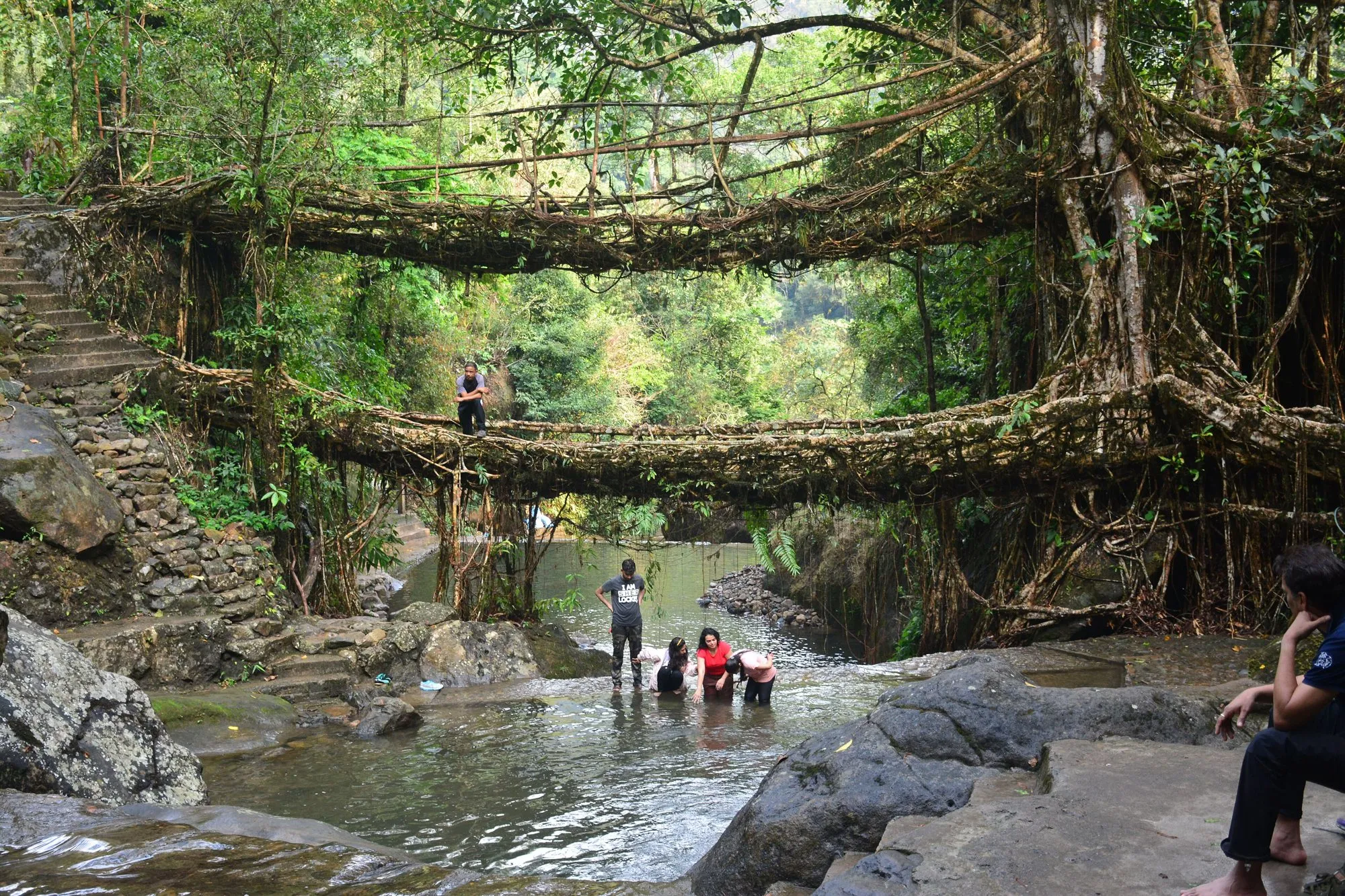
The Khasi and Jaintia peoples have long built bridges across the streams of these hills by training the aerial roots of rubber fig trees (Ficus elastica) across a river until they take root on the other side. One takes 10 to 15 years to grow strong enough to walk on, and then it gets stronger every year. Some are said to have been in use for centuries.
The double-decker bridge at Nongriat is the famous one: two root bridges, one above the other, over the same stream.
- Start at Tyrna, 12 km (about half an hour) from Sohra.
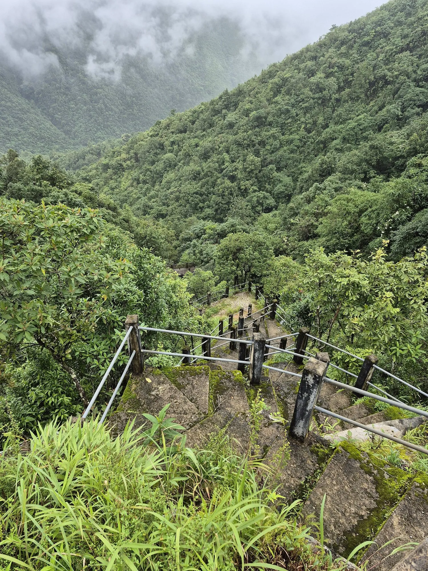
- Walk down about 3,500 stone steps, roughly 3 km, to Nongriat village. Allow a couple of hours down.
- Rainbow Falls is about another hour beyond the bridge, with a deep blue pool.
- The climb back up is the hard part. Start early, carry water, and leave plenty of daylight. Or stay overnight in one of Nongriat’s simple homestays and climb out fresh in the morning.
There’s a small entry fee at the bridge. Some recent reports say a registered local guide is now required for the trek, so check the current rule before you set off.
In and around Sohra
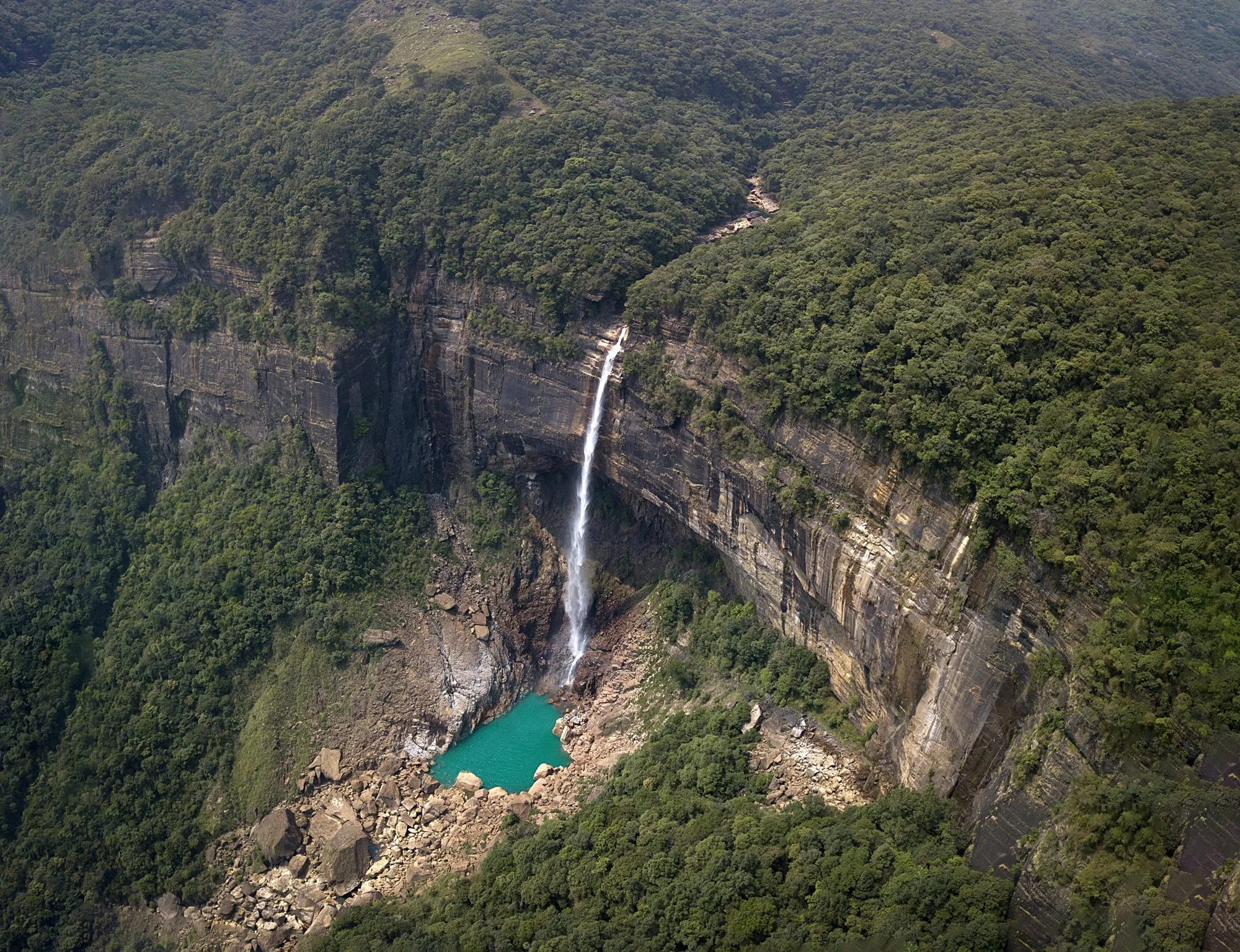
- Nohkalikai Falls: one of India’s tallest plunge waterfalls, dropping about 340 m into a turquoise pool. Small entry fee at the viewpoint.
- The steps and valleys: stairways drop from the plateau into deep green gorges all around the town.
- Caves: the limestone around Sohra is full of them; several are open to visitors.
In and around Mawsynram
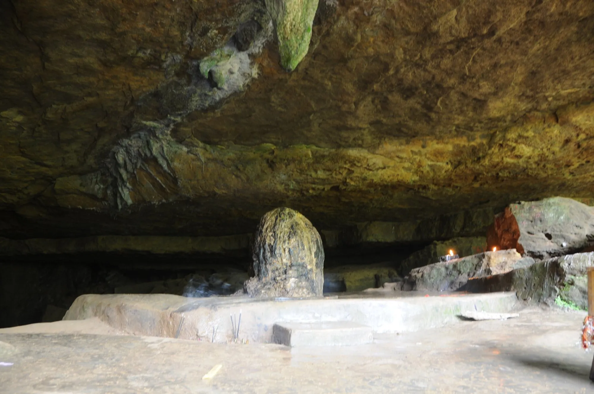
- Mawjymbuin Cave: a limestone cave just outside Mawsynram, known for a large natural stalagmite revered by Hindus as a Shiva lingam. Wear shoes with grip; the floor is wet and slippery.
- The weather itself: in the monsoon, clouds pour through the village and the rain can be astonishingly loud. That’s what you came for.
When to go
- June to September (the monsoon): June and July are the wettest months, with over 3,000 mm each in Mawsynram. The waterfalls are at their most powerful and the hills are an intense green. But views can vanish in cloud for days, the steps to Nongriat are slippery, and landslides can close roads. Allow spare days.
- October and November: the rains ease, the falls are still full, and views are clearer. For most visitors, this is the best compromise.
- December to February: dry, cool and clear. The waterfalls shrink to a trickle, and Sohra’s water shortage begins.
What to bring
- A proper rain jacket and an umbrella, quick-dry clothes, and a dry bag for your phone.
- Shoes with real grip for wet stone steps. Many trekkers prefer rubber sandals that can get soaked.
- Cash: small notes for entry fees, guides and homestays.
Every leg
Measured with Google Maps on 12 October 2026. Hill roads are slow, and slower still in heavy rain.
| Leg | Distance | Driving | From start |
|---|---|---|---|
| Guwahati airport→Shillong | 118 km | 3 h 05 | 118 km |
| Shillong→Sohra | 52 km | 1 h 36 | 170 km |
| Sohra→Tyrna | 12 km | 27 min | 182 km |
| Total | 182 km | 5 h 08 |
Free stops on this route
Places that cost nothing to visit. Rules for staying overnight are in the guide above.
- Free stop
Mawjymbuin Cave
Limestone cave with a natural stalagmite revered as a Shiva lingam.
Along the way

Sources
We last checked this guide on 12 Oct 2026. Roads, fees and rules change. If something is out of date, tell us at support@nexaround.com.



,_Meghalaya.jpg)