
The Nullarbor crossing is about 1,200 km of roadhouses and saltbush, and most people drive it as fast as the law allows. That's a mistake. Between Ceduna and Norseman there are lookouts, ruins, a pink salt lake and a few delightfully odd roadside landmarks, and almost all of them are free.
Here they are in westbound order, with how far each one is off the highway and what to know before you stop. Driving east? Read the list from the bottom.
The route at a glance
Tap a dot for details. Drag and zoom to explore.
Penong: windmills and a pink lake
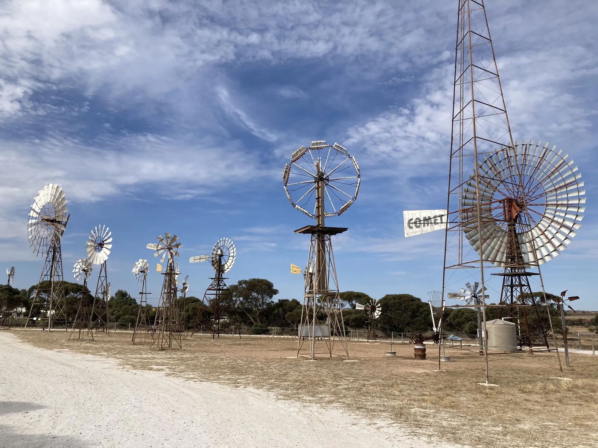
Penong Windmill Museum. Right beside the highway in Penong, 73 km west of Ceduna, volunteers have restored and re-erected a field of old farm windmills. The display opened in 2016, and its centrepiece is a huge Comet windmill nicknamed “Bruce”, said to be the biggest in Australia. It’s an open-air display: pull in, walk around, take the photo.
Lake MacDonnell. About 13 km south of Penong on the Point Sinclair road, a causeway crosses a salt lake that turns pink, coloured by salt and algae. The same road carries on to Cactus Beach, a well-known surf break.
Head of Bight: worth paying for
Not free, but if you cross between May and October it’s the one stop to pay for. Southern right whales come into the Head of Bight to calve, and a boardwalk and platform look straight down on them from the cliffs. It sits within the Yalata Indigenous Protected Area, about 20 km east of the Nullarbor Roadhouse. August is usually the best month. There’s an entry fee.
Bunda Cliffs lookouts
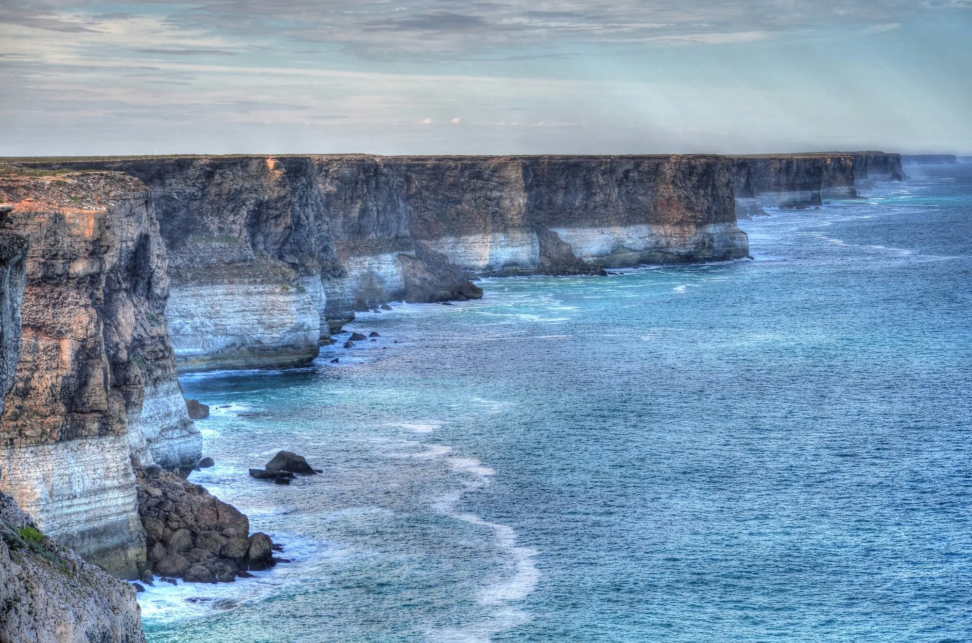
West of the Nullarbor Roadhouse the highway runs close to the edge of the continent, where the Bunda Cliffs drop more than 120 m into the Southern Ocean. There are three designated clifftop lookouts off the highway. Use only those: the cliff edge is unstable and collapses happen without warning. Camping along the cliffs is not allowed.
Border Village: Rooey II
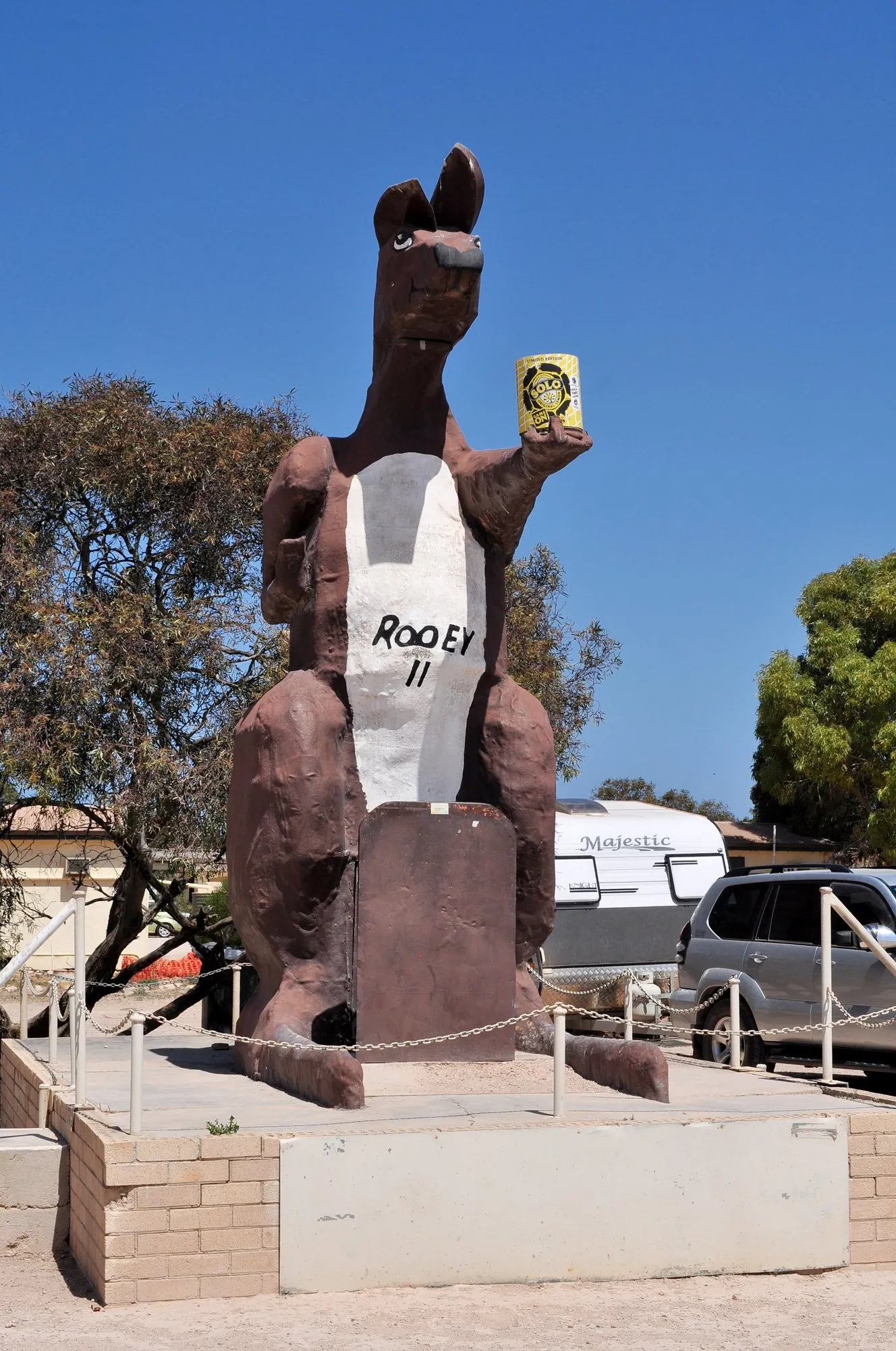
At the WA border, a giant kangaroo called Rooey II stands outside the roadhouse, can in hand. It’s the obvious photo of the crossing. While you’re there: this is where Western Australia’s quarantine check takes your fresh fruit, vegetables and honey, so eat them first.
Eucla: ruins in the dunes, and a jetty
Eucla Telegraph Station. A few kilometres south of Eucla, down a track towards the sea, stand the stone walls of a telegraph station opened in 1877. The dunes have been slowly swallowing it for decades.
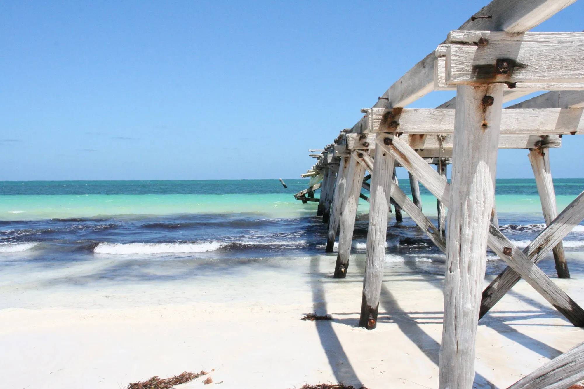
Eucla Jetty. Carry on to the beach and the old timber jetty runs out over white sand and turquoise water. It’s one of the most photogenic stops on the whole crossing, and almost nobody is there.
Madura Pass lookout
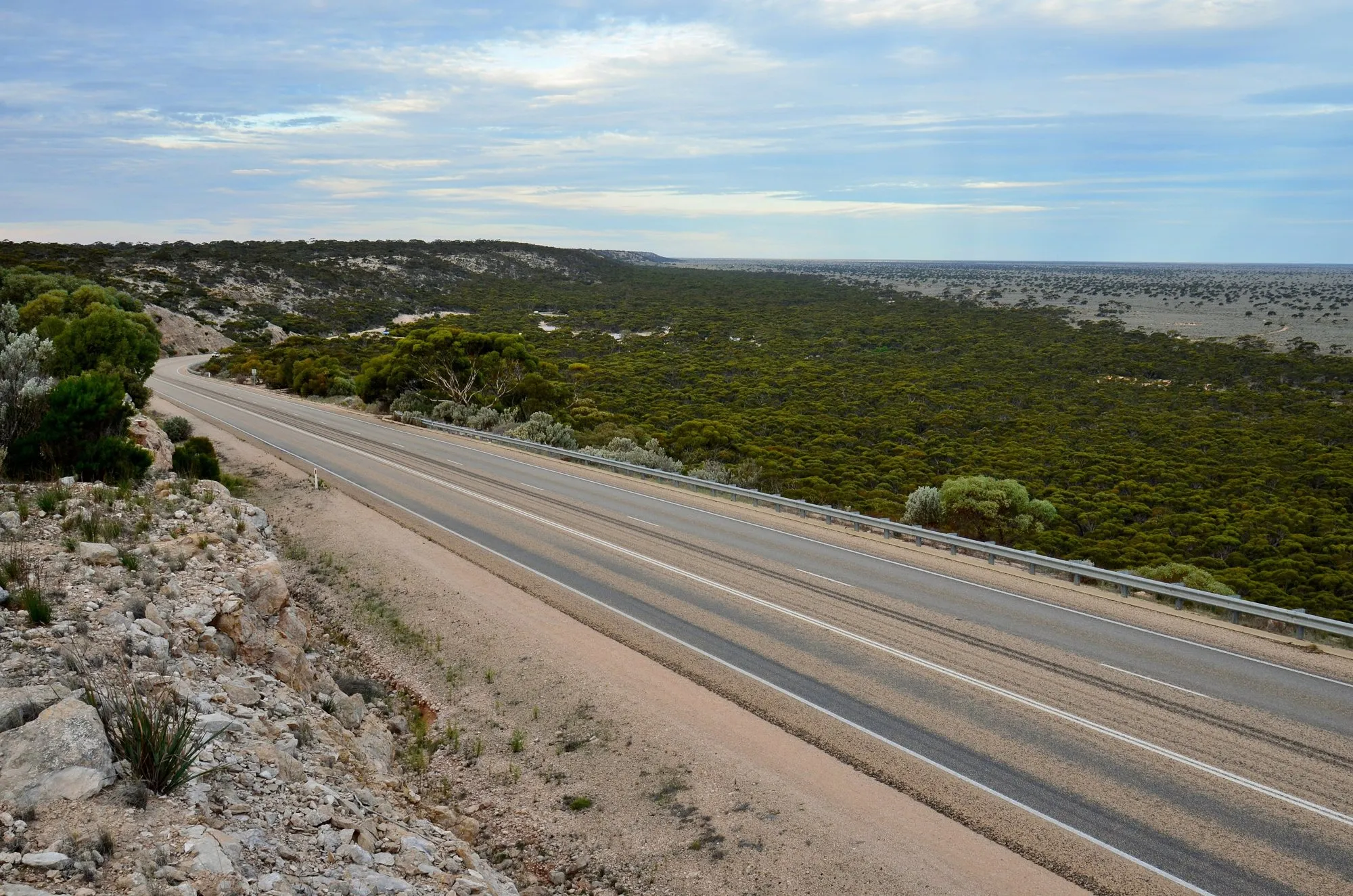
At Madura the highway drops down an escarpment onto the Roe Plains. The lookout beside the pass gives a wide view over the plain and the road running out across it. Good at sunrise and sunset.
Eyre Bird Observatory (detour, small fee)
About 50 km from Cocklebiddy, on the coast, BirdLife Australia runs a bird observatory in an old telegraph station. Day visitors are welcome but must book, and the last stretch of track is four-wheel drive only; the caretakers can arrange to meet you if you don’t have one. There’s a small entry fee.
Caiguna Blowhole
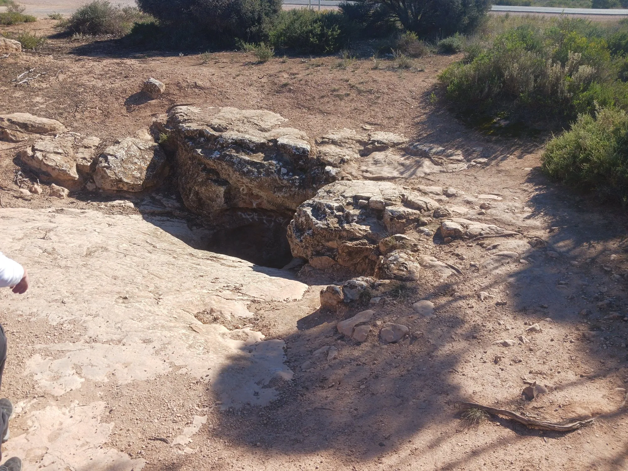
About 5 km west of the Caiguna roadhouse, a hole in the limestone breathes. Depending on the air pressure you can feel air rushing out of the ground, or being sucked in. Watch your footing around the edge.
The 90 Mile Straight
Between Caiguna and Balladonia the Eyre Highway runs 146.6 km without a single bend: Australia’s longest straight road. There’s a sign at each end, and stopping for a photo at one of them is a Nullarbor ritual. Pull fully off the road to do it; road trains don’t slow down.
Balladonia
The roadhouse at Balladonia has a small museum with pieces of the Skylab space station, which broke up over this area in 1979, along with displays on local history.
Sleeping for free: rest areas
Main Roads WA runs rest areas along the Eyre Highway. Those signed as 24-hour rest areas let you stop for up to 24 consecutive hours; they are meant for resting, not as campgrounds, so arrive late, leave early and take everything with you. On the South Australian side, there’s no camping along the Bunda Cliffs, and inside the Nullarbor Wilderness Protection Area camping is only at Koonalda Homestead, booked in advance.
Read every sign: rules differ from one rest area to the next.
For the full drive, with every leg and fuel gap measured, see our Adelaide to Perth road trip guide.
Free stops on this route
Places that cost nothing to visit. Rules for staying overnight are in the guide above.
- Free stop
Penong Windmill Museum
Open-air display of restored windmills beside the highway.
- Free stop
Lake MacDonnell
Pink salt lake, about 13 km south of Penong.
- Free stop
Bunda Cliffs lookouts
Clifftop lookouts over the Bight. No camping.
- Free stop
Rooey II, Border Village
The giant kangaroo at the WA border.
- Free stop
Eucla Telegraph Station
1877 ruins in the dunes.
- Free stop
Eucla Jetty
Old timber jetty on a white beach.
- Free stop
Madura Pass lookout
View over the Roe Plains.
- Free stop
Caiguna Blowhole
About 5 km west of Caiguna.
- Free stop
90 Mile Straight (east sign)
Start of 146.6 km without a bend.
- Free stop
90 Mile Straight (west sign)
The other end, east of Balladonia.
Along the way
Sources
- National Parks and Wildlife Service South Australia: Visiting the Nullarbor and the Bunda Cliffs
- Shire of Dundas: Eyre Highway (roadhouses and sights in Western Australia)
- Main Roads WA: Rest areas and amenities guide (24-hour rest area rules)
- Ceduna Tourism: Penong Windmill Museum
- BirdLife Australia: Eyre Bird Observatory
- South Australian Tourism Commission: Head of Bight Whale Watching Centre
We last checked this guide on 12 Oct 2026. Roads, fees and rules change. If something is out of date, tell us at support@nexaround.com.


.jpg)
.jpg)
