
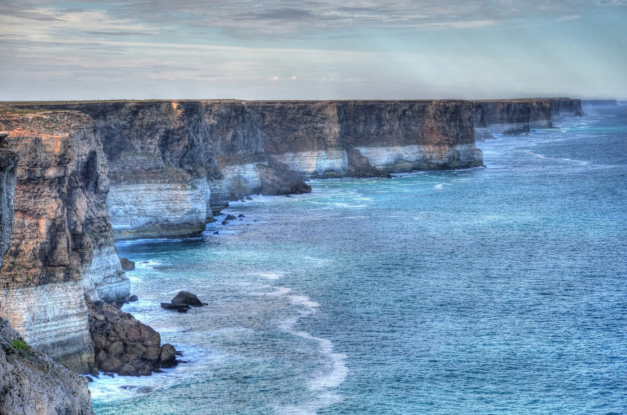
The drive from Adelaide to Perth is one of the great road trips on Earth, and one of the emptiest. For most of the way across the Nullarbor Plain there are no towns, only roadhouses, each one a fuel pump, a motel and a café, some of them nearly 200 km apart. Between them: saltbush flats to the horizon, the longest straight road in Australia, and cliffs dropping straight into the Southern Ocean.
This guide covers both ways to do it, with every leg measured, every fuel gap marked, and the stops along the way that cost nothing.
The route at a glance
Tap a dot for details. Drag and zoom to explore.
Direct or coastal?
The direct route follows the Eyre Highway from Port Augusta to Norseman, then the Great Eastern Highway through Coolgardie to Perth: 2,702 km and about 28 h 45 min of driving. At six to seven hours behind the wheel a day, that’s four to five days.
The coastal route takes in the Eyre Peninsula on the way out (Whyalla, Port Lincoln, Coffin Bay, Elliston, Streaky Bay) and Western Australia’s south coast at the end (Esperance, Albany, Denmark, Walpole, Pemberton, Margaret River): 3,607 km and about 38 h 36 min of driving. Add a few side trips to the national parks and it easily reaches 4,000 km. Give it at least ten days.
Both routes share the same core: the Nullarbor crossing between Ceduna and Norseman, about 1,200 km with nothing but roadhouses.
Fuel: the gaps that matter
From Ceduna to Norseman you fill up at roadhouses. These are the distances between them, measured on the road:
| From | To | Distance |
|---|---|---|
| Ceduna | Penong | 73 km |
| Penong | Nundroo | 79 km |
| Nundroo | Yalata | 53 km |
| Yalata | Nullarbor Roadhouse | 92 km |
| Nullarbor Roadhouse | Border Village | 184 km |
| Border Village | Eucla | 12 km |
| Eucla | Mundrabilla | 66 km |
| Mundrabilla | Madura | 116 km |
| Madura | Cocklebiddy | 91 km |
| Cocklebiddy | Caiguna | 65 km |
| Caiguna | Balladonia | 181 km |
| Balladonia | Norseman | 191 km |
The three long gaps are the ones to plan around. Fill up at every roadhouse even if the tank is half full, and carry enough to cover two legs in case a pump is out of fuel or a roadhouse is closed. Fraser Range Station, between Balladonia and Norseman, offers rooms and meals, not fuel.
At 10 litres per 100 km the direct route uses about 270 litres of fuel, and the coastal route about 360. Expect roadhouse prices well above city prices; on the WA side, FuelWatch publishes every station’s price each day.
Where to sleep
Roadhouses are the backbone of the crossing. Most have motel rooms and many have powered and unpowered sites; Mundrabilla, for example, has both. Book ahead in the busy winter months.
Free rest areas line the Eyre Highway, maintained on the WA side by Main Roads WA. Some allow overnight stays and some don’t: follow the signs at each one. A camping app such as WikiCamps shows the current list and recent reports from other drivers.
Two rules on the South Australian side:
- Camping along the Bunda Cliffs is not allowed. The cliff edge is unstable and collapses happen without warning.
- Inside the Nullarbor Wilderness Protection Area, camping is only at Koonalda Homestead, and you must book online before you arrive.
Free stops worth the brakes
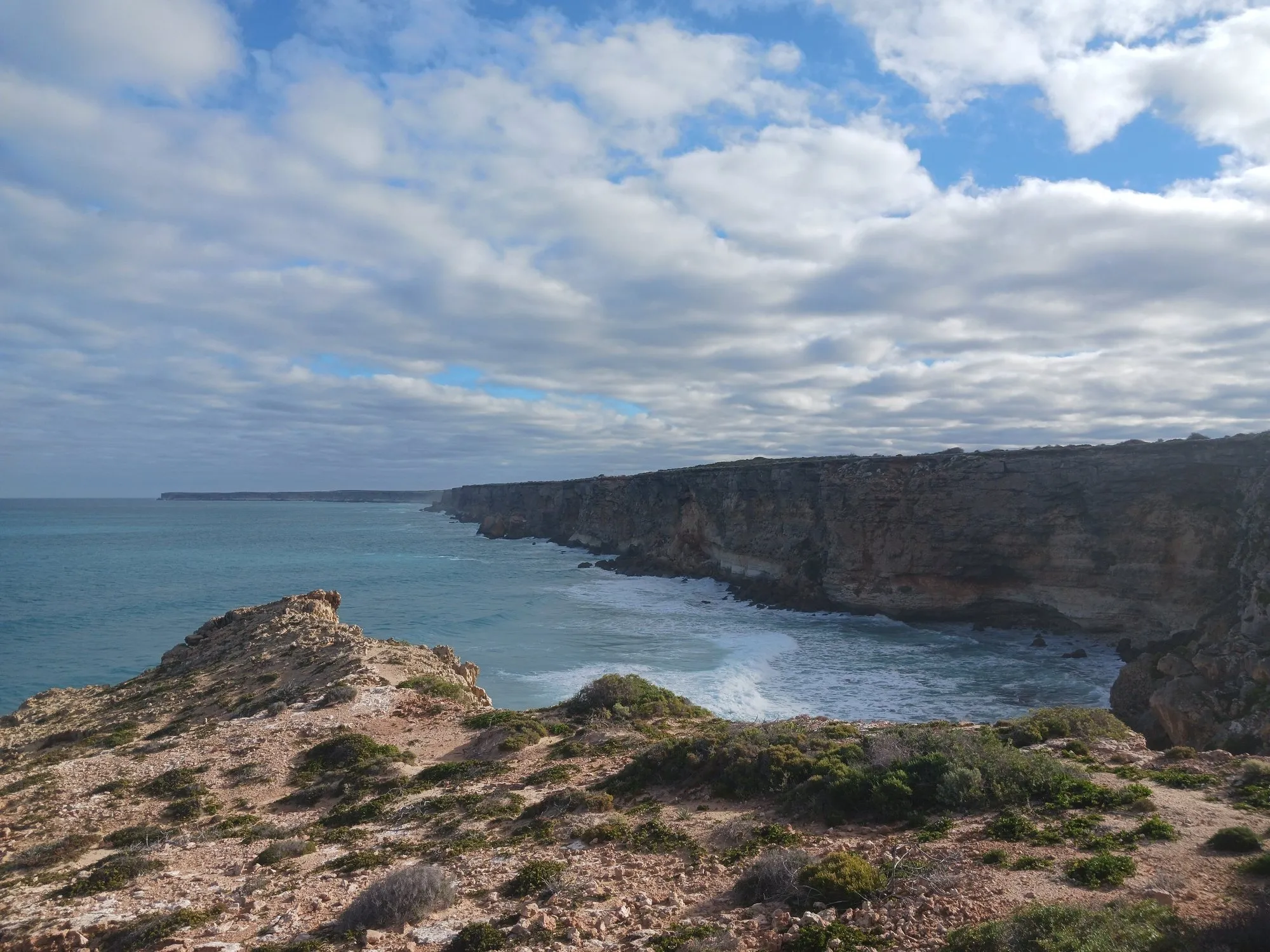
- Bunda Cliffs lookouts. Three designated clifftop lookouts between the Nullarbor Roadhouse and Border Village, over cliffs more than 120 m high. Stay at the lookouts and behind the barriers.
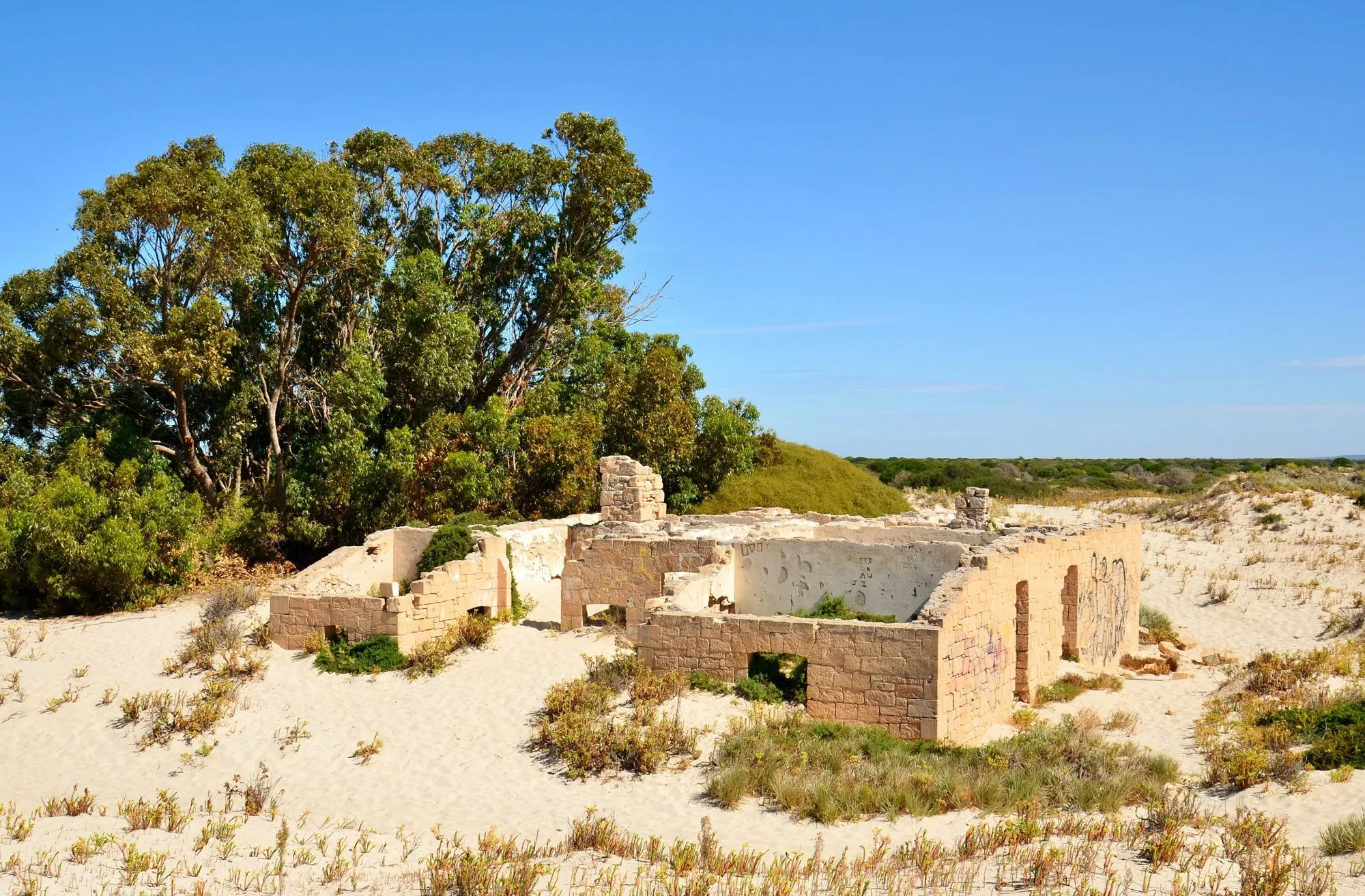
- Eucla Telegraph Station. The stone ruins of an 1877 telegraph station, a short walk south of Eucla and slowly being buried by the dunes.
- Caiguna Blowhole. A hole in the limestone about 5 km west of the Caiguna roadhouse. On the right day you can feel air rushing in or out.
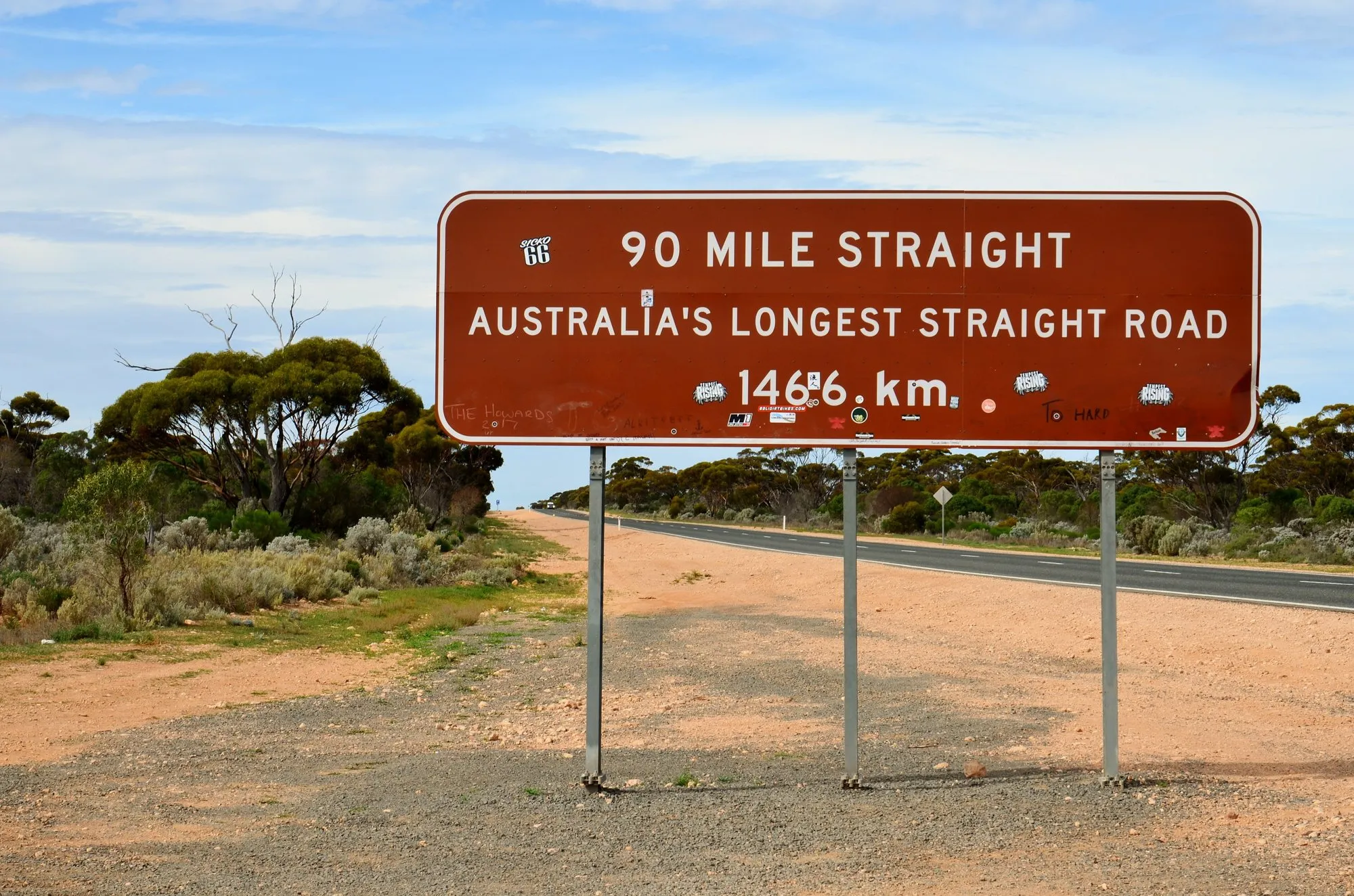
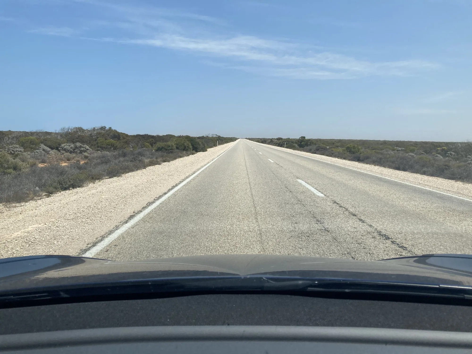
- The 90 Mile Straight. 146.6 km between Caiguna and Balladonia without a single bend, with a sign at each end that everyone photographs.
- Madura Pass. The lookout at Madura looks out over the highway and the plain below the escarpment.
One stop that is worth paying for: Head of Bight, where southern right whales come to calve between May and October. The viewing platform sits in the Yalata Indigenous Protected Area; August is usually the best month. There is an entry fee.
Clocks, quarantine and phone signal
Clocks. South Australia runs on Central Time (UTC+9:30, or +10:30 in daylight saving) and Western Australia on Western Time (UTC+8, no daylight saving). Between Border Village and Caiguna, the roadhouses keep their own unofficial Central Western Time, UTC+8:45. Westbound, you’ll change your watch at the border and again at Caiguna.
Quarantine. Western Australia checks every vehicle at the border. Fresh fruit, vegetables and honey are taken from you, and so is any packaging that held fresh produce. Most nuts are fine; raw walnuts in the shell are not. Eat or cook fresh food before the border, and use the bins at the checkpoint. If you’re unsure about something, Quarantine WA answers on (08) 9334 1800. Heading east, South Australia runs its own check at Ceduna.
Phone signal. Reliable signal is limited to the areas around the roadhouses. Download offline maps before you leave, and tell someone your plan and when you expect to arrive.
Driving it safely
- Avoid dawn, dusk and night. That’s when kangaroos, wombats and other animals are on the road.
- Give road trains room. Overtake only with a long, clear view ahead.
- Stop every two hours. The roadhouses are natural breaks; so are the lookouts.
- Carry water, food and a good spare tyre, and make sure the car is serviced before you set off.
- Watch for the airstrip markings. Some straight stretches of the highway double as emergency landing strips for the Royal Flying Doctor Service.
When to go
Winter, from June to August, is the most comfortable time to cross: the days are cooler and it’s whale season at Head of Bight. In summer the heat on the plain is serious, so start early, carry extra water, and keep the hottest hours for the roadhouses.
Costs at a glance
| What | Cost |
|---|---|
| Fuel, direct route | About 270 litres at 10 L/100 km; check current prices |
| Fuel, coastal route | About 360 litres at 10 L/100 km |
| Roadhouse motel room or powered site | Varies by roadhouse and season; phone ahead |
| Head of Bight entry | Small fee; check before you go |
| Bunda Cliffs, Eucla ruins, Caiguna Blowhole, 90 Mile Straight | Free |
Every leg
Direct route, town to town. Measured with Google Maps on 12 October 2026, using the roadhouses' own locations.
| Leg | Distance | Driving | From start |
|---|---|---|---|
| Adelaide→Port Augusta | 308 km | 3 h 23 | 308 km |
| Port Augusta→Ceduna | 468 km | 4 h 54 | 776 km |
| Ceduna→Nullarbor Roadhouse | 296 km | 3 h 05 | 1,072 km |
| Nullarbor Roadhouse→Border Village | 184 km | 1 h 54 | 1,256 km |
| Border Village→Eucla | 12 km | 11 min | 1,268 km |
| Eucla→Mundrabilla | 66 km | 42 min | 1,334 km |
| Mundrabilla→Madura | 116 km | 1 h 13 | 1,450 km |
| Madura→Cocklebiddy | 91 km | 57 min | 1,541 km |
| Cocklebiddy→Caiguna | 65 km | 42 min | 1,606 km |
| Caiguna→Balladonia | 181 km | 1 h 52 | 1,787 km |
| Balladonia→Norseman | 191 km | 2 h 01 | 1,978 km |
| Norseman→Coolgardie | 167 km | 1 h 45 | 2,145 km |
| Coolgardie→Southern Cross | 187 km | 1 h 55 | 2,332 km |
| Southern Cross→Merredin | 110 km | 1 h 10 | 2,442 km |
| Merredin→Perth | 260 km | 3 h 01 | 2,702 km |
| Total | 2,702 km | 28 h 45 |
Free stops on this route
Places that cost nothing to visit. Rules for staying overnight are in the guide above.
- Free stop
Bunda Cliffs lookouts
Clifftop lookouts over the Great Australian Bight. No camping.
- Free stop
Eucla Telegraph Station ruins
An 1877 telegraph station slowly disappearing under the dunes.
- Free stop
Caiguna Blowhole
About 5 km west of the roadhouse. You may feel air rushing out of the ground.
- Free stop
90 Mile Straight
146.6 km without a bend, signed at both ends.
Along the way
Sources
- National Parks and Wildlife Service South Australia: Visiting the Nullarbor and the Bunda Cliffs
- Shire of Dundas: Eyre Highway (roadhouses and sights in Western Australia)
- WA Department of Primary Industries and Regional Development: What can I bring into WA?
- South Australian Tourism Commission: Head of Bight Whale Watching Centre
- Top Wire Traveller: Fuel stops across the Nullarbor
- FuelWatch, Government of Western Australia (daily fuel prices)
We last checked this guide on 12 Oct 2026. Roads, fees and rules change. If something is out of date, tell us at support@nexaround.com.
.jpg)
.jpg)
.jpg)

.jpg)